
(9/21/2014) Perhaps the most spectacular road my friend Mitch and I rode during our June-July 2014 adventure to British Columbia—by way of the Tetons—was was our transit across the Beartooth Pass on the Beartooth Scenic Byway. This was one of my “must-do” requests when we were planning our ride, even though it would take us 100-200 miles out of the way. Mitch later told me he was very grateful I urged him to include this road as he was as impressed as I was.
I work with a fellow named Matt who has a brother living in Red Lodge, Montana. Red Lodge is at the eastern end of the Beartooth Pass. Matt visited his brother a couple of years ago, in the summer, and drove on the Beartooth Highway. He told me it was the highlight of his trip. Soon thereafter I read an article in HOG Tales that described how great a ride it is. That sealed it for me. I had to ride it for myself.
 On top of the world
In a cross-country ride filled with spectacular views and sometimes scary roads, none was more amazing than the Beartooth Highway, at least equal to Going-to-the-Sun Road. It's a section of US 212 that takes you up to almost 11,000 feet, high enough where you find yourself looking down at other snow-covered mountains.
This was Day 5 of our adventure and that morning, in Jackson Wyoming, we were looking up at the Teton range. By late afternoon were looking down at such peaks. We felt like we were on top of the world.
 Snow falls on the Beartooth Highway even in the summer!
Just two weeks before we arrived there, “an early summer storm” caused the Montana Department of Transportation to close the Beartooth Highway due to “blowing and drifting snow.” At a stop in Yellowstone National Park, Mitch and I asked about the weather conditions on the Beartooth and had been informed of the recent storm by a park employee. He told us we were in luck and that road conditions up there were clear and relatively safe.
In the photo above, right you can see me standing in a field of snow that's at least eight inches deep. Mitch and I enjoyed throwing a few snowballs.
That evening as we ate a late dinner with Mitch’s friend John at a restaurant in Bozeman, John told us that we were fortunate in our timing, as that day—July 2—was the warmest day of the year so far. Much of the snow on the high pass had melted only recently. We got to enjoy relative warmth and sunshine in what can often be a hostile environment.
While we were up there, on top of the world, we stopped several times to play in the snow and stare in awe to the south and southwest (toward Yellowstone) at the seemingly endless chain of mountaintops...trying to see where we had been earlier that day. On our trip, and especially on that day, we had many miles to cover, but couldn't resist pausing and taking in the magnificence of it all.
 Cooke City to Red Lodge
The Beartooth Highway runs from Cooke City, Montana in the west to Red Lodge, Montana in the east but is mostly in the state of Wyoming, as you can see on the accompanying map.
The Beartooth is just northeast of Yellowstone National Park. It thus makes sense that tourists such as ourselves would ride the Beartooth Highway on our way to or from Yellowstone. In our case, we had just departed Yellowstone and were working our way—in a roundabout fashion—to Bozeman, Montana, where we were scheduled for dinner and an overnight stay. (Yes, we scheduled ourselves for a ridiculously long ride.)
Cooke City is a very small town (pop: 120) but a convenient place to fuel your bike before heading into the mountains. Red Lodge, on the other hand, has a population of more than 2,000 people. Like I wrote earlier, my colleague Matt has a brother who lives there. As you can imagine, the winters are cold and the snow that falls tends to stay put until spring. It will not surprise you then that Red Lodge has a disproportionately large number of pubs. :-)
When we were in the Badlands the previous day, Mitch described his ideal house as small with a garage for his motorcycle along a small river out in the country. Coincidentally, we saw exactly these kinds of homes in Red Lodge along Rock Creek. We agreed that perhaps this was a bit too far out in the country. :-)

Lots of snow and ice
There were snow banks along the road higher than our heads, on July 2!. We stopped at Long Lake for photos, and like another rider—a fellow from California on a BMW—we were impressed by the ice on the lake.
In the photo at right, that's Mitch standing behind our bikes and in front of an icy Long Lake. There was actually a port-o-potty (see photo below) at this parking area. Seemed like a wierd place for such a thing but with Red Lodge another hour to the east and there being no trees along the road for cover, a port-o-potty might look like a bladder's oasis.
For a little while, we were so far above the tree line that it looked like we had left planet earth and had arrived on Mars. All that was there were rocks. It's remarkable how quickly one can go from thick forests to moon-like terrain when ascending steep mountainsides.

Not much traffic up there...
The Beartooth Pass is open only for about four months each year, opening on the Saturday before Memorial Day and closing in mid October depending on the weather. Given this small window of opportunity to experience this magnificent road and the fact that it was the week of Independence Day, we were pleasantly surprised by how few people were up there.
In the photo, above left, that's Mitch next to his Gold Wing. In the background you can see the port-o-potty and the rider from California, with his BMW. We're at Long Lake.
I doubt we saw more than two dozen other motor vehicles over the entire 60+ mile stretch. Even more surprisingly, we encountered only one other biker (the guy from California).
 Mitch and I were impressed with the BMW when its rider told us that he was quite comfortable on what looked to us like a small bike. Given that Mitch was on a Gold Wing and I was on my Harley Electra Glide, I suppose almost any other bike looks small compared to ours.
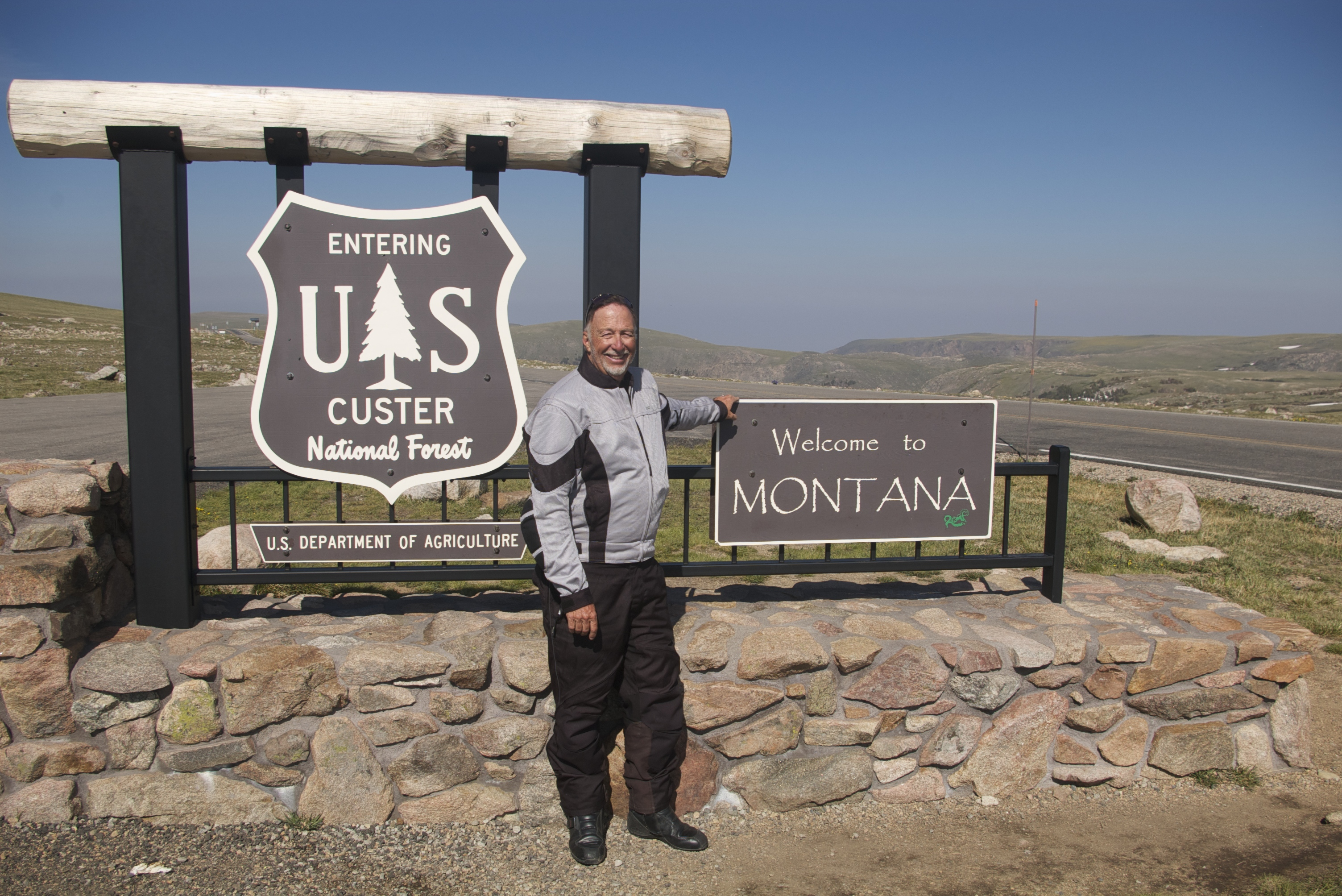
Highest state border so far
This was the highest state line crossing for me so far. I'm not sure what the elevation was but I'm confident it was close to 8,000 feet if not higher. The accompanying photos of Mitch and me at the state line were on the eastern crossing on the Beartooth Highway.
Oftentimes we want to take photos in front of these kinds of signs but it's not safe. In this case, the Park Service provides a parking area and as I wrote above, we practically had the entire place to ourselves.
 Put this one on your bucket list...
This road should be on your top ten ride list along with others such as the Pacific Coast Highway (California 1), Going-to-the-Sun Road (Montana), Blue Ridge Parkway (Virginia and North Carolina), US A1A in southern Florida to Key West, and the Dalton Highway (Alaska).
As always, keep the shiny side up.
-The Long Rider